
Bowen'
GIS Blog
Lab 2: Exploring Fragstats
In this lab, we explore how the landscape around Edmonton has changed from 1966 to 1976. We did by examining some Fragstats metrics, as well as by creating a transition matrix that explicitly shows the transformation of landuse over time.
Rapid urbanization is the major cause of landscape change. In the context of Edmonton, Alberta, expanding urban built-up area not only occurs at its core urban center but also in suburban areas in the form of dispersed patch settlement. From 1966 to 1976, the total urban area of Edmonton has expanded almost 4 times. The increasing urban land use replaces cropland, pasture and forage crops, swamps and bogs, as well as woodlands. Urbanization creates potential threats to food security problem and inefficiency of governmental service for distanced urban regions. It could also negatively impact the ecosystem of surrounding woodland.
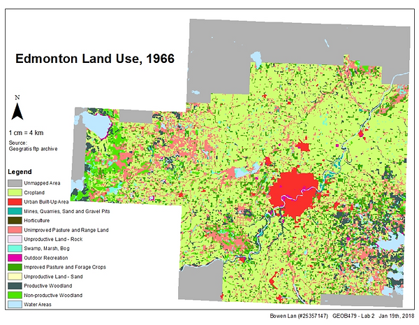
Map 1: Edmondon Land Use, 1966

Map 2: Edmondon Land Use, 1976
Map1and 2 shows the landscape of Edmonton city in 1966 and 1976. In 1966, most of the land was cropland, and in 1976, although cropland still dominated large patches, many of it had been converted for other uses. The core urban region marked by red grew one time in size in this ten years of time, and there was also an emergence of a second urban core, southwest of the existing core city in 1976. East of the core city, and far south of it, also experienced patch development of urban built-up areas. Water area remained the same across time. Another noticeable growth of land mass was the increase patches and size of the productive forest. It increased majorly at the far southbound of the city.